Land Grants and Legal Claims
Land maps were made to support legal claims by Spaniards and natives alike in the colonial period. Like the Relaciones Geográficas maps, land maps made by indigenous artists and communities responded to the demands of the Spanish colonial government in a hybrid visual style, combining distinctively Mesoamerican and European elements.
Pre-Hispanic traditions of mapping land tenure and tribute relationships were well established. But colonial indigenous maps created for legal actions emphasized information and visual elements that would mean most to Spanish judicial officials. They tended to highlight land use and ownership rather than history or community, identify places with words rather than pictures, and specify distances between towns and landmarks.
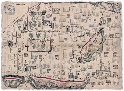
This collection of four maps was part of a 1584 legal petition filed by Don Joaquín de Francisco Moctezuma, a landholding cacique(indigenous local ruler) of Tepexi, Puebla, against a royal merced, or land grant, to be given to Doña Alonça de Sande, a Spaniard. The granting of a merced required legal documentation to prove that the lands in question were uncultivated and free of any other legitimate claims to ownership. This set of maps mark the lands to be granted to Doña Alonça, as well as the territories owned by Don Joaquín and cultivated by terrazgueros, indigenous tenant farmers, who paid tribute to him and to the crown.
The horizontal map was likely produced at the behest of the cacique Don Joaquín. His lands are clearly delineated in red lines near the map’s top left. Notations read “Sementeras (cultivated lands) are patrimony of Don Joaquín de San Francisco,” “Possession,” and “Sementeras of Don Joaquín de San Francisco, cacique.” The lands, showing abundant corn and pumpkin crops, were farmed for the cacique by terrazgueros whose own houses and plots are tightly clustered across the map. The densely represented agricultural activity underscores that these lands were occupied and cultivated, which would preclude their being absorbed into a new land grant.
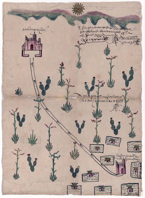
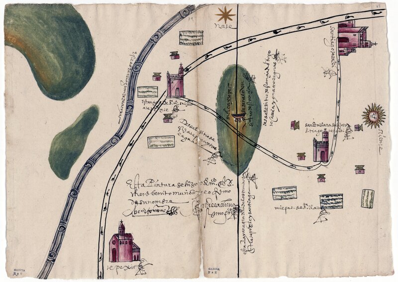
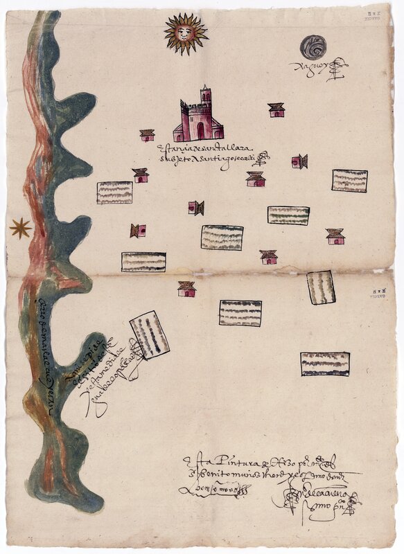
The three vertical maps seem to have been created together as part of the original land grant petition. An inscription on each states “this pintura was made by the hand of Sr. Benito Muñoz and signed with his name.” Muñoz was probably an indigenous notary for the local Spanish corregidor (official), Gerónimo de la Cueva, whose own signature appears alongside the artist’s. De la Cueva’s initials throughout the maps confirm written details related to the merced petition, such as the note in the middle map at right that states “here in these plains are requested two caballerías (210 acres) of land (aquí se piden en estos llanos las dos caballerías de tierra).”